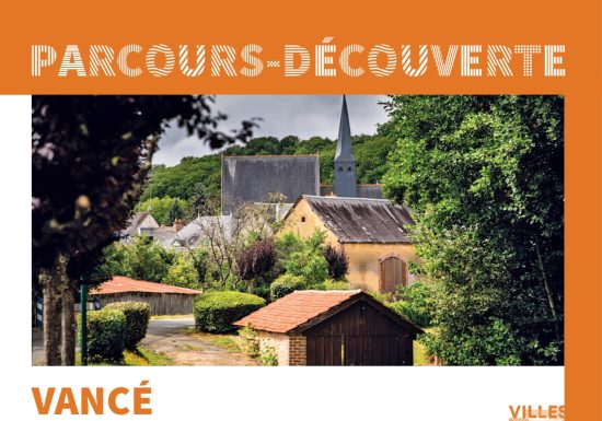


Situated on the south-western edge of the Calais plateau, incised by deep valleys, the commune is bordered by watercourses belonging to the Braye basin, the two main ones being the Charmançon and the Tusson. Its origins may date back to Gallo-Roman times, but its history became clearer in the Middle Ages thanks to the discovery of coins. At the beginning of the 19th century, following a major demographic boom, Vancé became home to a large number of craftsmen. In 1810, there were thirteen weavers, twelve builders: four stonemasons, one bricklayer, one carpenter, three joiners, three tile masons and many other craftsmen to meet everyday needs.
Map and full description of the route available in the Guide Rando du Perche Sarthois (50 routes).
On sale at Perche Sarthois tourist offices for €10.